How Michael Baker leverages unmanned aircraft systems for infrastructure inspections
From the Winter 2018/2019 issue of Signature
In January 2017, torrential rains caused heavy flooding along Nevada Route 446 and forced the Nevada Department of Transportation (NDOT) to close the roadway, which is a vital corridor for towns such as Nixon and Sutcliffe in the Pyramid Lake Region northeast of Reno. Because the road was largely inaccessible by land due to outfalls along the highway or inspection using high-flying aircraft due to persistent cloud cover, NDOT couldn’t get close enough to examine the damage.
For help, NDOT called on Michael Baker International, a leader in the use of small unmanned aircraft systems (UAS) for a variety of engineering and mapping purposes, including aerial inspections. Michael Baker assembled two UAS teams, which coordinated approximately 30 UAS flights over the stricken areas, producing both still images and 3D point-cloud data.
Within five days, the teams presented NDOT with a survey-grade surface that enabled the department to get a handle on the damages and plan for repairs and future mitigation. While it took another few weeks for NDOT to fully implement and complete the roadway’s significant cleanup and repair, that was a far quicker timeframe than might have been possible without using UAS technology and an image-data processing approach.
ACCELERATING SCHEDULES, CUTTING COSTS, REDUCING RISKS
As the dramatic Highway 446 project demonstrates, UAS is a growing phenomenon in engineering, inspection services and related fields. Because of their flexibility and maneuverability, drones can reach places that might be difficult — and hazardous — for hands-on inspectors to access. UAS can provide data and images in real time and in a variety of formats, accelerating project schedules while cutting some “boots on the ground” expenses associated with recurring site visitations for inspectors and surveyors. The gain in worker safety also is significant. While the number of inspections required will stay the same, the lessening of risks to hands-on inspectors by providing them the right tools for the job is important. Yet commercial UAS is a far cry from the recreational activities that most people imagine when they think of drones. To start, the variety of uses and situations for drones — airframes, as they’re often called — has prompted manufacturers to produce a wide variety of models with different capabilities. Additionally, the cameras and sensors that the airframes carry are just as diverse for such purposes as photography, video, infrared, thermal, LiDAR, hyperspectral and radiation data collection.
Each flight usually entails a pilot and a visual observer/ sensor operator to ensure the proper images are collected — and the airframe returns safely with its payload intact. Visual observers provide pilots with immediate feedback on airspace incursions or unauthorized personnel entering the project boundaries.
In addition, deploying UAS may require flying into controlled airspace as well as in close proximity to ground and water-borne traffic. Thus, coordination among the Federal Aviation Administration (FAA), local airports’ control tower staff, law enforcement and state and local highway authorities is key to a successful mission.
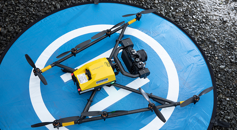
Michael Baker began building its UAS expertise in 2015, when it became one of the first in the industry to receive FAA certification to operate both fixed-wing and vertical-takeoff-and-landing UAS. The Company quickly determined that UAS technology provides clients with several decided advantages — it allows for highly efficient data capture, can improve safety when compared to conventional techniques and is flexible and scalable for adaptation to most data-gathering situations. Michael Baker committed significant resources to growing its UAS capabilities so that today, it offers fleet of approximately 30 airframes and as many pilots.
Operation of UAS for engineering and professional services purposes is a complex yet valuable tool that likely will continue to grow in demand for applications. Rodney Cope, who serves as Michael Baker’s remote sensing program lead in its Round Rock, Texas, office, has been involved with aerial imaging systems, UAS and other cutting-edge scanning technologies for about 20 years. He sees a demand shift ahead.
“The industry is moving toward lightweight, compact and specialized sensor packages that are suitable for UAS and applicable to data collection of smaller areas,” says Cope. “These sorts of operations require much higher image and data resolution for use with cell towers, or roadway and infrastructure inspections where we are providing very high-definition, sensor-derived data and providing it quickly.”
Michael Baker is at the frontline in using UAS for a variety of purposes. In the fall of 2018, the company worked with the Kentucky Transportation Cabinet (KYTC) on a UAS-assisted inspection of the Daniel Carter Beard Bridge — commonly known as the “Big Mac Bridge” — that connects Cincinnati with Newport, Ky. Using a combination of UAS and rope access inspectors, the team produced a complete assessment of the cables for the entire span. Although a holistic fracture critical and routine inspection was performed, UAS reduced the time required for the cable inspection in half by scanning the cables full-length. The cables were previously rappelled for the first time in the history of the bridge in 2016.
Also, in 2018, Michael Baker served the needs of the executive office for West Virginia Gov. James C. Justice. The local pilot collected UAS video of earthwork and construction activities along the eight-mile highway corridor (Corridor H), currently under construction, just north of Elkins, W. Va. The Governor’s office used the photographic images and video to record this important ceremonial activity and shared photography with local media for overall public awareness and citizen outreach purposes.
While the firm has done some technically amazing and important work with UAS, a pair of Michael Baker’s innovative projects serves as specific examples of UAS services, including inspecting a historic bridge and providing vital assistance for the Highway 446 flood emergency.
THE NATCHER BRIDGE – A SUCCESSFUL UAS TRIAL
The William H. Natcher Bridge is a historic structure that carries U.S. Highway 231 across the Ohio River between Kentucky and Indiana. When it opened in 2002, the 4,505-foot span was considered the country’s longest cable-supported bridge over an inland waterway. In 2017, KYTC undertook an inspection of the bridge and engaged Michael Baker for assistance.
Because the Natcher Bridge provides relatively unimpeded access to all cables, it seemed the ideal environment for UAS. The KYTC-Michael Baker team originally envisioned a hybrid pilot study — half the inspection conducted by traditional rope access, half by UAS. But when inspectors rappelled down the bridge, they were buffeted by strong wind currents. Though the winds were unrelenting, they proved to be a blessing in the skies, so to speak. Those untenable rappelling conditions prompted the inspection team to modify its approach; they would rely heavily upon an inspection of the entire bridge with UAS and verify a sampling of cables hands-on.
From its extensive fleet, Michael Baker used two professional-grade airframes, which feature a dual-battery system that can extend flight time as well as self-heating technology that allows these UAS to function in lower temperatures. Moreover, this professional-grade aircraft can accommodate a variety of video formats. The inspection team determined that video rather than still photography could provide the best inspection record for both the current project and as a benchmark for future inspections.
The team included John Zuleger, P.E., a Michael Baker bridge and rope access group leader and UAS pilot, and Jeff Sams, an inspector and professional rope access technical specialist and UAS pilot in Michael Baker’s Louisville office. Sams designed test flights for inspections to ensure the aircraft could detect potential flaws to the exact tolerances specified by KYTC. For the actual inspection missions, the pilot-in-command was directed by Alicia McConnell, P.E., transportation engineer for Michael Baker. McConnell is a UAS pilot and served as the sensor operator for such a technical mission conducted in a difficult environment for flights.
The results were outstanding. The team scanned a total of 96 cables in two days, and one workday was devoted to video processing and review. Had the inspection used rope access exclusively, it probably would have taken five to seven days to complete – not including photo logging and documentation.
As for the quality of the video, that, too, was first-rate. The team accurately captured all defects previously tagged in rope inspections. Best of all, the airframe was able to detect a one-eighth-inch crack in a high-density polymer casing. A follow-up inspection by rope access indicated the casing was leaking grease rather than rust. The crack was not yet a safety issue, but its detection enabled KYTC to note the flaw for future observation and repair.
The results impressed Evan Dick, former KYTC project manager. “Through our limited use of UAS on bridge inspections, we have found value in both added safety and cost savings,” he said. “Scanning the stays with UAS decreased the time needed for an inspector to be on rope by up to 75 percent. UAS can be a valuable tool when used in the right situations.”
Zuleger and McConnell echoed those thoughts.
“It is a really powerful tool where rope access is limited or less efficient,” Zuleger said. “It mitigates the hazards for inspectors. For more intricate areas, you must be hands-on. If you keep a ‘tool in the toolbox’ mentality, UAS technology is very applicable in many situations.”
Added McConnell, “There is somewhat of a misconception that our UAS airframes will replace current efforts for surveying or inspection. Their true value is found in the ability to supplement those necessary manual tasks.”
LET’S GET THIS ROAD OPEN!
When Nevada DOT’s State Route 446 was flooded and closed in early 2017, Michael Baker was already using UAS while working with NDOT’s Stormwater Division personnel on several UAS-assisted projects.
“We provided data and images for drainage basins so that they could observe any changes over time,” said Polly Boardman, PMP, project manager and office manager of Michael Baker’s Reno office. “When the storms and flooding hit in winter of 2017, the need for UAS for quick turnaround collections at various locations intensified and didn’t stop all season, from bridge inventories to the Lahontan Dam release video. This collection at Route 446 was the first of many projects where UAS was the best technology for the job.”
The flooding kicked the partnership into a new gear, tackling the biggest problem – access. How could Michael Baker’s UAS team reach State Route 446 to scan the roadway and its damaged surroundings? To meet that need and others, NDOT brought in emergency crews to construct temporary roads of sand, providing limited vehicular access. The UAS team used a four-wheel-drive vehicle and makeshift roads to reach Route 446.
“As long as we followed the emergency construction crews, we could get close enough to the damaged areas of the road to fly,” says Adam King, GIS analyst and UAS pilot for Michael Baker and a member of the project’s UAS team. “Having that highway effectively destroyed in places really affected local communities. NDOT said, ‘Whatever it takes, let’s get this road open.’”
The UAS team split into two squads. One utilized a fixed-wing airframe with a longer flight duration while the other deployed a multirotor airframe with a higher resolution sensor that focused on “blowouts” on the route. Between the two aircraft, the team was able to collect imagery of the entire 15-mile stretch of highway in a very short timeframe with high-resolution images of the affected areas.
The team provided NDOT with still images and a dense 3D point cloud generated by an algorithm-based method known as Semi-Global matching (SGM). SGM produces a dense point cloud from photogrammetry principles producing a Digital Terrain Model (DTM) with LiDAR-like quality.
The production of the DTM facilitated calculations of how much earthen fill was required to restore the road’s original grade for serviceability and its reopening. After the images were put to use for immediate reconstruction purposes, the team exported the data to a Microsoft HoloLens “mixed reality” computer and produced for NDOT a holographic panorama they could manipulate with hand motions to visualize the route’s damage and contemplate potential solutions for its reconstruction.
“UAS was a big help in identifying areas that needed repairs,” confirmed Tyler Thew, stormwater design manager for NDOT. “It was great to be able to see upstream and downstream areas, to see impacts that were not visible from the road. Having a visual view of the entire area better showed us why some areas were impacted, and others were not. The holograph helped to convey how much damage was done. It made the impact really evident to our decision makers.”
Thus, the agency was able to develop and implement its remediation plan . . . and think about the future.
“Our output allowed them to see the hills behind the highway from which stormwater runoff could result in future weaknesses of the road,” Boardman says. “NDOT could better determine where and how they would need to add or improve their existing culverts.”
“Not every situation where we use UAS is as urgent as what we faced with NDOT,” notes Robert Hanson, GISP, Michael Baker’s senior vice president of technology. “But our company’s expertise in UAS takes data collection to a much higher professional level than most others when dealing with design engineering or professional surveying-related mapping.
“Our UAS capabilities build upon our company’s full continuum of innovative solutions while immediately enhancing the abilities of our technical experts for planning and efficiently executing projects in surface transportation, utilities infrastructure land development, pipelines and many other markets,” Hanson said. “We are better able to gather data more quickly, safely and efficiently, representing both short- and long-term value to our clients.”