A Collaborative Journey for Better Bus Service in Pittsburgh
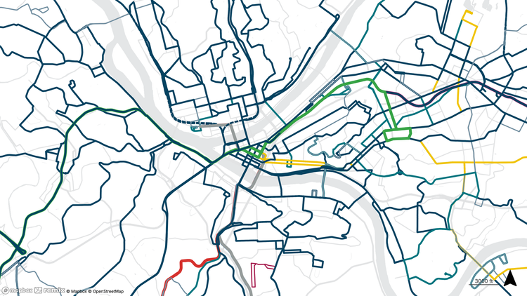
Design Hub by Michael Baker International is transforming the way transit planning is conducted in the Pittsburgh region. In August 2023, the Design Hub team kicked off Bus Line Redesign, a comprehensive bus network redesign project for Pittsburgh Regional Transit (PRT). The project team closely examined the entire system on a route-by-route basis to identify areas for improvement with the goal of ensuring the best possible service for the region’s bus riders. A major component of the project involved technical analyses to understand the COVID-19 pandemic’s impact on ridership and help adapt transit service to a changing Pittsburgh region.
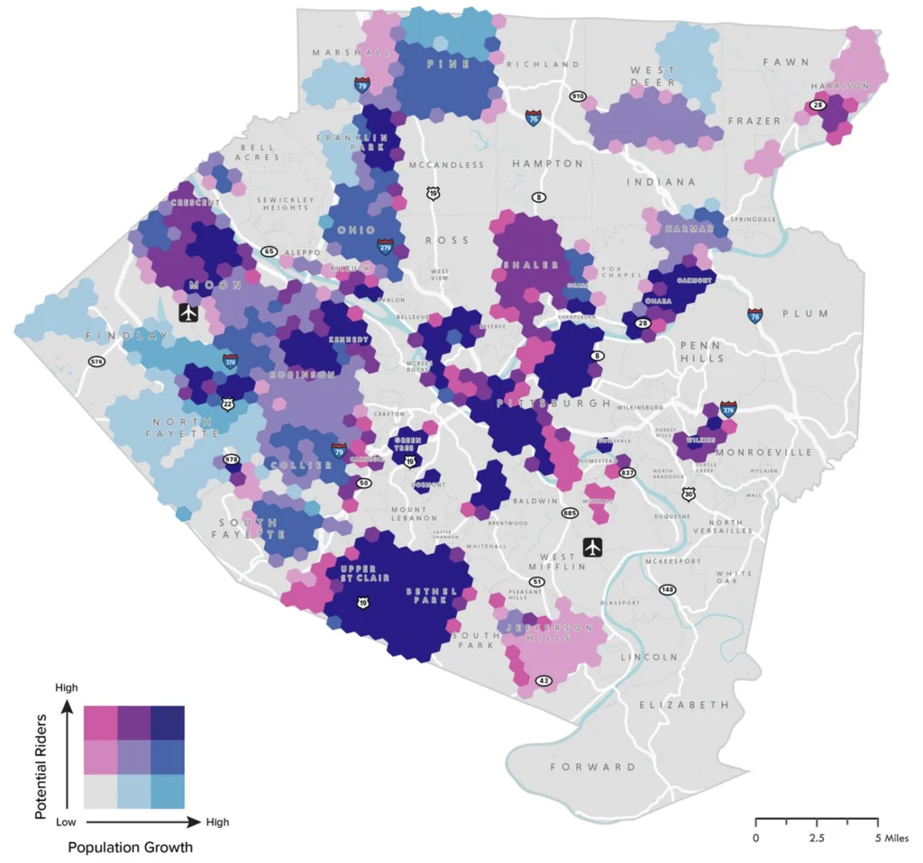
The Design Hub team placed a large focus on utilizing travel pattern data for decision making. Recent advancements in cell phone location data allow for the anonymization and aggregation of millions of trip patterns, indicating where and when people are traveling and for what purposes they are making those trips. This enables us to reveal factors like emerging hotspots for employment or areas where reverse commutes are becoming more popular. At the same time, the analysis reinforced what the team already anecdotally knew to be true: commuter bus ridership dropped significantly after March 2020, and while people are still using transit (albeit fewer of them), they now use it differently. It’s important for planners to understand this shift in commuting trends to ensure that service is meeting riders’ needs, especially in an uncertain funding environment. Every operating dollar is precious, and every service hour spent chasing areas with weak transit demand is an hour not spent on a critical link somewhere else.
As of Spring 2025, the Bus Line Redesign project is about to enter its fourth round of public engagement, where riders will get the chance to see the modified bus network once more and leave feedback on it before the final draft is complete. The Design Hub team places a strong emphasis on comprehensive engagement, using engaging maps, graphics, and dynamic community engagement methods to meet riders where they are in their communities.
Co-creating a transit network with the community ensures that the system truly reflects the needs, preferences, and daily experiences of its users. Unlike a top-down approach, which can overlook critical local insights and result in inefficiencies or limited usage, collaborative planning fosters trust, encourages diverse input, and leads to more equitable and effective transit solutions. Engaging maps and graphics play a crucial role in this process by making complex data accessible and interactive, helping participants visualize current conditions and future possibilities. These tools empower communities to contribute meaningfully, spark informed dialogue, and build shared ownership over the transit network’s design and success.
For more information, the PRT Bus Line Redesign Travel Pattern Analysis report can be found here.
transit | data | maps