Home Services Surveying

Surveying

Legacy in Surveying and Mapping Excellence

Since our founding in 1940 as a surveying and engineering design firm, surveying and mapping have been integral to Michael Baker’s identity. Today, we deliver comprehensive surveying and mapping services across all engineering disciplines, combining advanced technology with the expertise of skilled professionals. Our team ensures accurate data collection, interpretation and integration—providing the precision and reliability that drive successful projects.

Beyond the activities of our crews in the field is a diverse team that includes licensed land surveyors, survey analysts, mapping specialists, researchers, coordinate geometry calculation experts, and quality control and assurance managers. Our team effectively combines data gathered via various methods, including conventional collection, static/mobile LiDAR and UAS photogrammetry, to complete comprehensive, customizable and scalable deliverables for projects of any size. Our wide-ranging surveying expertise and more than 105 professional land surveyors and technicians enable Michael Baker to efficiently complete even the most challenging survey assignment.

Surveying

  • Aerial Photogrammetry
  • Topographic Mapping
  • Construction Staking
  • Monitoring Surveys
  • Cadastral Surveying
  • Construction Surveying Monitoring Surveys
  • Global Positioning Satellite Surveying (GPS)
  • High-Definition Surveying
  • Laser-Imaging Services
    • Detailed Architectural Surveys
    • Deformation Monitoring of Complex Structures
    • Highway/Bridge Topography
    • Existing Assets Inventory
    • Ground Penetrating Radar
    • Airborne LiDAR Digital Elevation Model
    • CADD Viewer Software and Client Training

Mapping

  • Final Parcel Maps
  • Final Tract Maps
  • Plan Checking Services
  • Records of Surveys
  • ALTA/ACSM Land Title Survey Maps
  • Boundary Survey Analysis
  • Corner Records
  • Digital Submissions of Maps
  • Legal Descriptions and Exhibits
  • Lot Line Adjustments
  • Utility Research and Identification
  • Land Net Mapping
  • Title Exception Investigation
  • Appraisal and Right of Way Mapping
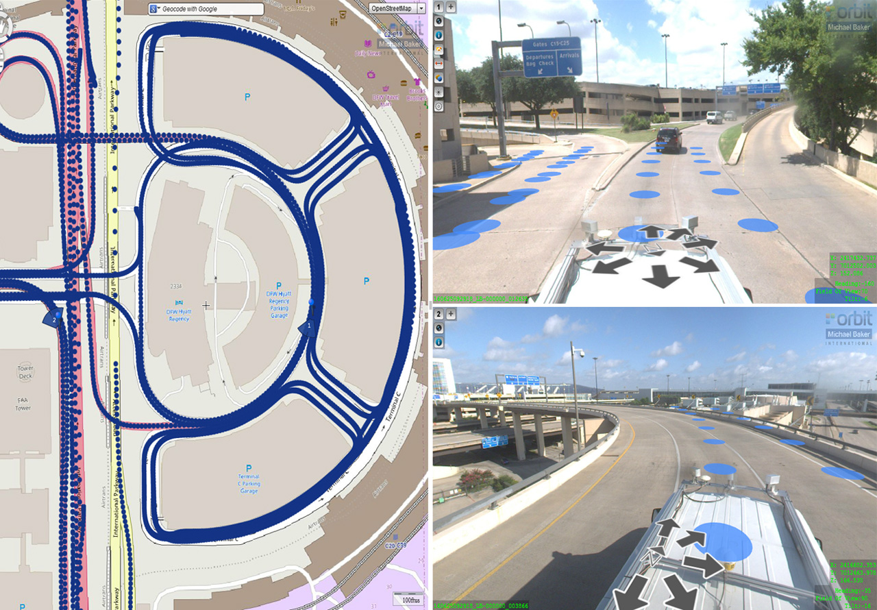
Our surveyors are experienced in delivering substantial projects in transportation, utilities, healthcare, military and municipal infrastructure. Advances in technology have revolutionized the surveying profession and we have trained and invested in new methods and equipment, like mobile LiDAR, photogrammetry and unmanned aircraft systems (UAS), to better serve our clients.

Steve Slocum, P.L.S.

Survey/Mapping Department Manager – Steve has more than 20 years of survey/mapping experience. He has worked in numerous disciplines of land surveying, including boundary, heavy civil engineering, airport runway construction, tunnel alignments, profile staking and verification, static and mobile LiDAR applications, control networks, settlement and deformation, cadastral mapping and geophysical surveys